

In industries like logistics, ride-hailing, food delivery, and courier services, accurate navigation and efficient route planning directly impact operational efficiency and customer satisfaction. To address these challenges, Google Maps Platform has recently introduced two Pre-GA features: the Geocoding Destination API and the Routes API in Maps JS.
These updates are more than just incremental API enhancements—they deliver more granular location intelligence and advanced routing capabilities. For example, in the past, delivery drivers were often directed to the center of a large shopping mall or business complex, struggling to find the correct entrance. With the Geocoding Destination API, systems can now point drivers directly to the right entry point, saving time and reducing delays. Meanwhile, the Routes API supports flexible planning for multiple stops within a single trip, as well as mixed-mode routes that combine driving, walking, public transit, or even two-wheelers—making complex routes both faster and more accurate to calculate.
In the following sections, we’ll break down the key features, differences, and real-world applications of these two APIs, helping you understand how to integrate them into your business or applications for maximum impact.
Geocoding Destination API – Precise Navigation to Every Building Entrance
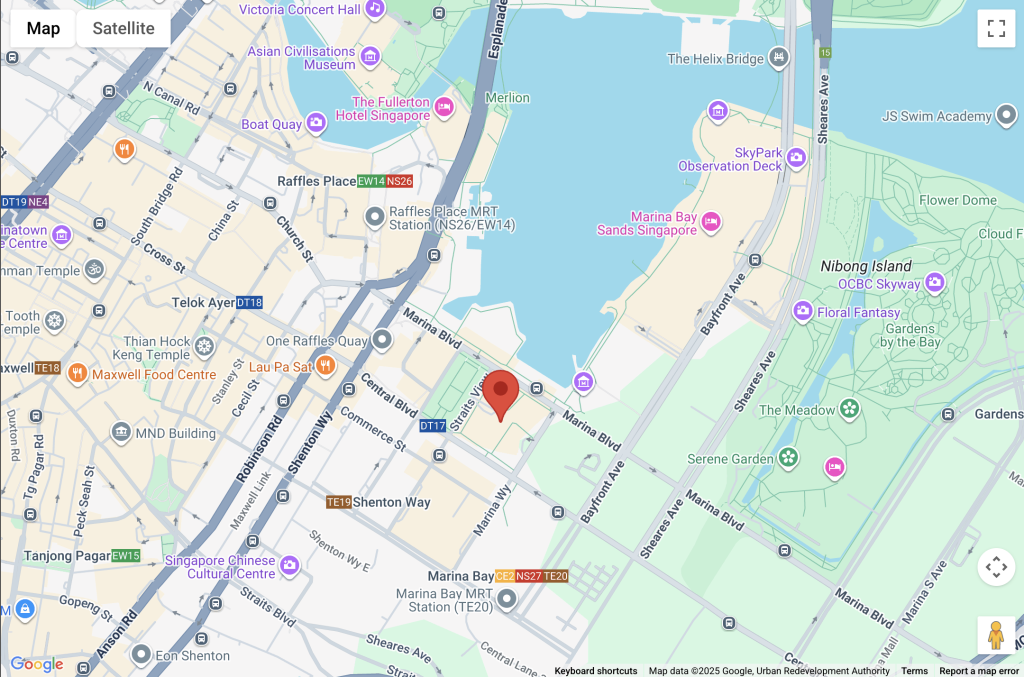
Drivers often struggle with inaccurate drop-off points or missing building entrances—leading to misdeliveries, delays, unnecessary detours, and higher operational costs. The Google Maps Geocoding Destination API (Pre-GA) is designed to solve exactly these challenges. Beyond traditional geocoding that converts addresses into latitude and longitude, it introduces enhanced capabilities such as building footprints, entrance data, and AI-powered Destination Summaries, enabling drivers to arrive at the right location with far greater accuracy—significantly improving navigation precision and operational efficiency.
How Does Geocoding Destination Differ from Traditional Geocoding?
Limitations of Traditional Geocoding
- Address resolution typically points to the center of a building, leaving drivers or couriers struggling to find the correct entrance.
- It cannot support detailed navigation in large complexes or industrial parks. Address consistency is limited—moving a pin within the same building may result in different addresses.
Upgrades with Geocoding Destination API
- Provides building footprints and entrance information, guiding navigation directly to the most accessible entry point.
- Maintains consistent addressing, even when users move a pin within the same building.
- Upcoming AI Destination Summaries will generate intelligent descriptions of destinations, further enhancing the user experience.
How Does It Improve Driver Navigation and Destination Accuracy?
- Delivery & Logistics : Ensures couriers reach the customer’s specified entrance directly, reducing misdeliveries and repeated navigation attempts.
- Ride-Hailing: Enables drivers to precisely locate passenger pick-up points, shortening wait times and improving the overall ride experience.
- Business Value: Cuts down operational time and costs, while boosting efficiency—especially valuable in high-traffic areas or complex building environments
Source: Master Concept

Source: Master Concept
Routes API in Maps JS Preview – Multi-Waypoint and Multi-Modal Route Planning
Whether it’s logistics delivery, ride-hailing, travel itineraries, or retail foot traffic management, accurate and efficient route planning directly impacts service quality and operating costs. With the Routes API now available in Maps JavaScript, developers can calculate optimized routes across multiple stops and transportation modes in real time—all with a single API. This makes it easier for businesses to manage trips and deliveries flexibly and effectively, while also reducing development time and ensuring a smoother navigation experience for users.
How Does Routes API Improve on the Legacy Directions API and Distance Matrix API?
Key Feature Highlights
- Real-time traffic polylines: Displays color-coded traffic conditions along routes, giving users clear visibility into congestion.
- Multi-modal support: Seamlessly plans routes for walking, driving, public transit, and two-wheel vehicles.
- Dark Mode & Route Helpers: Provides map styles compatible with dark mode and convenient tools for drawing and rendering routes.
Impact on Development and User Experience
- Developers can replace multiple legacy APIs with a single API, reducing integration and maintenance costs.
- Users benefit from more accurate, real-time routes and ETA predictions, improving navigation confidence.
- Enhanced route visualization and multi-modal switching provide more flexible travel options.
How Do Multiple Waypoints Help Businesses Optimize Routes?
The Routes API allows businesses to include multiple stops in a single trip and automatically optimize their order to minimize time and distance. Instead of being locked into a fixed sequence that may cause detours or inefficiency, routes are dynamically calculated based on real-time traffic conditions and road constraints, ensuring more precise and efficient journeys.
Practical Use Cases & Business Value
- Courier & Delivery: Reduce detours and idle travel, boosting delivery efficiency.
- Ride-hailing & Shared Mobility: Increase driver utilization and reduce passenger wait times.
- Travel Itinerary Planning: Maximize sightseeing efficiency by sequencing stops intelligently.
- Public Transport Operations: Plan inspection, collection, or maintenance routes more efficiently to reduce costs.
How Does Routes API Enable Unified and Flexible Multi-Modal Route Planning?
The Routes API supports multiple transportation modes—including walking, driving, public transit, and two-wheel vehicles—and connects them into a seamless, end-to-end journey. For example, public transit routes automatically combine walking segments to and from stations, transfers, and transit rides into one coherent plan. Two-wheeler and bicycle routing are optimized for narrow streets and traffic restrictions, ensuring smooth passage.
With a single API, developers can handle multi-modal needs without having to integrate multiple services. This not only simplifies development but also equips systems to adapt dynamically to different scenarios. Combined with near-real-time traffic data, route planning is no longer just about calculating distance—it’s about delivering practical, efficient, and highly accurate travel solutions.

Google Maps Platform Redefines Smart Navigation and Route Planning
As a Google Maps Platform partner and geospatial solutions expert, we see precise destination accuracy and dynamic route optimization not just as technical enhancements, but as strategic levers for improving operational efficiency and user experience.
The combination of Geocoding Destination API and Routes API empowers businesses to manage transportation and delivery networks from both a macro and micro perspective. From our observations, these capabilities provide three key insights for enterprise decision-making:
- Resource Allocation & Cost Optimization — Accurate route planning reduces unnecessary detours and idle time, saving labor and fuel costs.
- Enhanced Service Experience — Whether in logistics, ride-hailing, tourism, or retail, precise arrivals and real-time traffic insights directly improve user satisfaction and loyalty.
- Data-Driven Strategic Planning — With multi-modal route analytics and historical trend insights, businesses can design long-term operations and contingency strategies with greater confidence.
As AI and real-time data become increasingly integrated, businesses will be able to respond more proactively to traffic fluctuations and operational challenges. Leveraging these mapping tools is not merely a technical upgrade—it is a strategic asset that enables organizations to elevate efficiency, enhance service quality, and strengthen decision-making across the board.



![[Free Webinar] Road to COP17: Unifying Enterprise Data with Planetary-Scale Geospatial AI](https://masterconcept.ai/wp-content/uploads/2026/09/Webinar-261007-Unifying-Enterprise-Data-with-Planetary-Scale-Geospatial-AI-_1280x720px-scaled.png)