

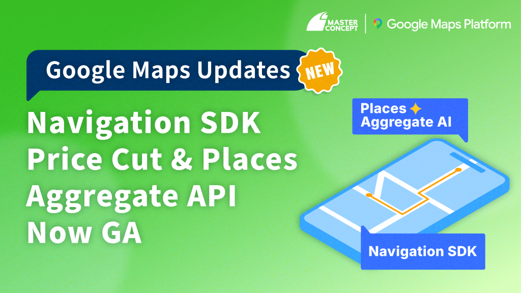
Business expectations for “maps” have outgrown simple display and routing. Today’s enterprises demand smarter, more integrated tools that directly boost operational efficiency. For industries heavily relying on spatial decision-making—such as logistics, delivery, retail and real estate—leveraging mapping APIs can make or break development speed, operating costs, and competitive edge.
Google Maps Platform has just rolled out two major updates:
- Significant price reduction for its real-time navigation SDK
- General availability of Places Aggregate API (former Place Insights API) designed for large-scale place analytics.
Here’s why these enhancements deserve your attention—and how they can empower you to make smarter decisions and deployments.
1. Navigation SDK Price Slashed: Build Custom Routing at Half the Cost
For years, many logistics and mobility services have wanted to embed turn-by-turn guidance directly into their apps—but worried that development and operating expenses would skyrocket. Now, Google Maps Platform has cut the per-destination fee of the new Navigation SDK by over 50%, making basic in-app navigation far more accessible. Volume-discount thresholds have also been lowered: you’ll unlock reduced rates with fewer destination requests, while the monthly free tier of 1,000 destination requests remains unchanged—so small-to-medium teams can experiment without fear of unexpected bills.
For fleets numbering in the hundreds or thousands, this means you can maintain the same service level at half the cost, greatly improving your long-term budget control and expansion potential. Interested in a hands-on trial? Contact us for a pre-built navigation app template and get up and running in no time.
2. What Is the Navigation SDK—and Why It Matters
The Navigation SDK delivers far more than static route maps. It incorporates Google’s rich traffic data, turn-by-turn guidance logic, and polished UI components, offering an in-app experience on par with native Google Maps navigation. Developers can flexibly embed maps, routes, and turn-instruction cards directly within their apps—so navigation feels like a built-in feature, not an external bolt-on.
1. Shared-ride platforms can offer riders the fastest, safest routes.
2. E-commerce logistics can reroute drivers around congestion, boosting on-time delivery rates and fuel efficiency.
3. Multi-stop deliveries benefit from live traffic updates and dynamic rerouting, optimizing driver routes in real time—something static maps simply can’t match.
3. Real-Time Traffic Tracking: A Better Driver Experience
Road conditions change instantly—a crash or construction zone can derail your entire schedule. The Navigation SDK’s real-time traffic feature solves this by alerting drivers to incidents and suggesting alternate paths. If a planned route hits a construction zone, the SDK auto-updates your ETA and offers detour recommendations, keeping your operations smooth and your drivers on the fastest possible tracks.

4. Places Aggregate API GA: Region-Level Insights Made Easy
Beyond routing, enterprises also need to analyze location data at scale—for site selection, market research, and risk assessment. Historically, gathering hundreds or thousands of place records required painstaking data cleansing, deduplication, and statistical aggregation—often a project for specialized data engineers.
Enter the new Places Aggregate API (formerly Place Insights API). Now generally available, it lets developers pull aggregated statistics on points of interest within any area—no heavy lifting required. For example, you can instantly retrieve:
- The count of “open” coffee shops in a neighborhood
- The average rating of mid-priced restaurants (rating ≥ 4.0)
The number and average score of medical clinics within a specified radius
Heatmap Insights
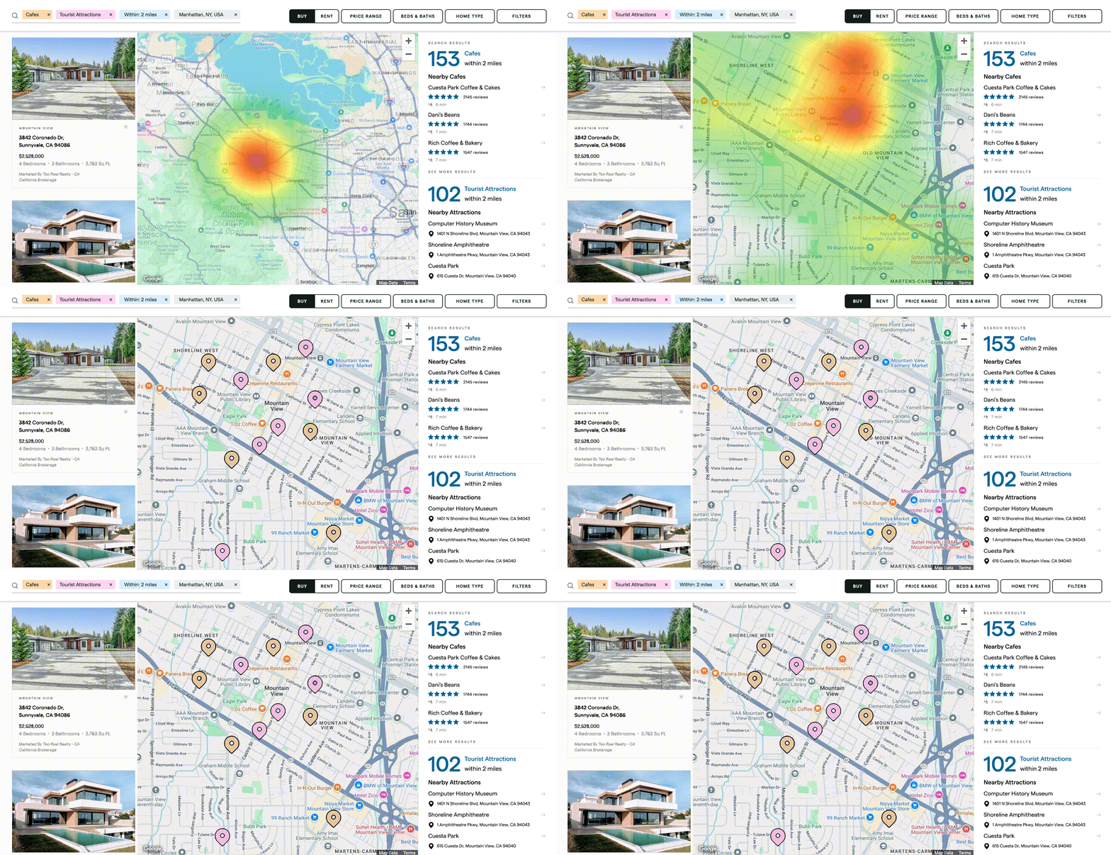
By calling the Heatmap endpoint, you’ll get density data matched to your filters, ready to be rendered as color gradients in your UI. In seconds, you can produce interactive heatmaps that spotlight high-opportunity areas—whether cafés, restaurants, or pharmacies—without any tedious data prep. For example, a coffee chain’s marketing team could instantly identify the busiest corridors, overlay average spend and competitor locations, and narrow their list to three to five ideal store candidates—all in a fraction of the usual time.
Custom Scoring Models
Places Aggregate API also returns raw metrics—such as place counts, average ratings, and price distributions—so you can assign your own weights and craft a bespoke “location score.” Planning a pharmacy rollout? Weight factors like nearby medical facilities and road accessibility more heavily, then incorporate local senior-population data for a holistic score tailored to your business rules. Whether you’re in real estate development, retail rollout, or municipal planning, this flexibility lets you quantify and compare sites in minutes instead of weeks.

This feature holds significant potential across various applications. For example:
- Retail chains can quickly compare commercial density and competitive landscape across different locations to support site selection and store planning.
- Real estate platforms can display neighborhood convenience scores directly on the map, enhancing the user experience.
- Financial institutions can incorporate local commercial activity levels as a reference for credit assessments or investment decisions.
5. Conclusion: Tools That Don’t Just Save Time—They Make You Better
From slashing navigation costs to democratizing large-scale area analysis, Google Maps Platform’s latest enhancements target the most pressing pain points of modern enterprises. Whether you’re development-driven, operations-focused, or data-centric, these new offerings deliver compelling solutions.
1. Navigation SDK Price Cut: Build custom, in-app routing with industry-leading traffic intelligence at half the cost.
2. Places Aggregate API GA: Transform raw place data into actionable heatmaps and custom scores—no data-science team required.
Geospatial intelligence is more than maps on a screen; it’s about seeing clearly, moving efficiently, and deciding smartly. Ready to integrate these features into your workflow or explore a bespoke integration? Get in touch and let Maps power your next phase of growth.
-1024x256.png)


![[Free Webinar] Road to COP17: Unifying Enterprise Data with Planetary-Scale Geospatial AI](https://masterconcept.ai/wp-content/uploads/2026/09/Webinar-261007-Unifying-Enterprise-Data-with-Planetary-Scale-Geospatial-AI-_1280x720px-scaled.png)